When you can't fly a helicopter for various reasons here in ALASKA the next best alternative is hiking this beautiful land with your family
"Click on photos for a closer look"
Me, Crow Pass (3500 ft) (Mile 4) on our way down to the Eagle River valley in the back ground. Lessons learned: My back pack was too heavy for a 26 mile day hike. My right knee became irritated at 19 miles, too much weight due to the size of the water bladder. Next time I'll carry less water and resupply more often with the water filter. The SPOT is spotty when in the trees. It needs a clear view of the sky to transmit your current position. Next time I'll hold it straight up to the sky when I'm in a clearing to make sure the OK message gets out to my wife. She became a little concerned when she didn't get a message for a couple of hours while I was in the trees on the Eagle River side of the trail.
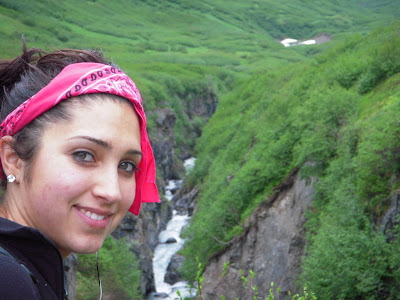
Laura (our daughter) at Raven Gorge (mile 7) it was a beautiful day for a hike. By that I mean a little sun but mostly clouds and no rain with a dry trail. Too much sun will sap the energy right out of you.
Laura (mile 10.5) what a trooper, her left knee gave out on her with about 9 miles to go, she persevered! Eagle Glacier and Lake behind her.
Me and my trusty .357 magnum, is that a bear over there? (mile 10.5). Eagle Glacier and Lake behind me pretty close to where we have to ford the river.
Raven Gorge (mile 7) Can you see the rock that looks like a bear?
Me and John (our son) (mile 5) John did a good job on this hike with plenty of energy to spare.
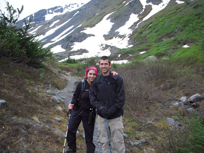
Laura and John on the way down after summiting Crow Pass (mile 5)
John enjoying the sun (mile 11ish). Is that a bear behind you?
Laura
Raven Glacier (mile 4) This is what you see at the top of Crow Pass
Moose antler we found at Turbid Creek (more like a river) (mile 9.5) Notice where the porcupines gnawed on the horn? They eat the horns for the nutrients.
Raven Gorge (mile 7) This is an amazing site, the photo does it no justice. It's a very sharp, sudden, deep, rocky cavernous drop off. I'm guessing 75 to 100 feet. A hike to this gorge alone, and back to the Girdwood trail head would make an excellent day trip.
Raven Gorge (mile 7)
Raven Gorge with John standing and waiting; he's ready to move on and make some progress.


